


Here is the link to the NWS Grand Rapids Storm Summary
Here is the link to the NWS – Detroit Storm Summary

Link to Northern Indiana Office Storm Summary


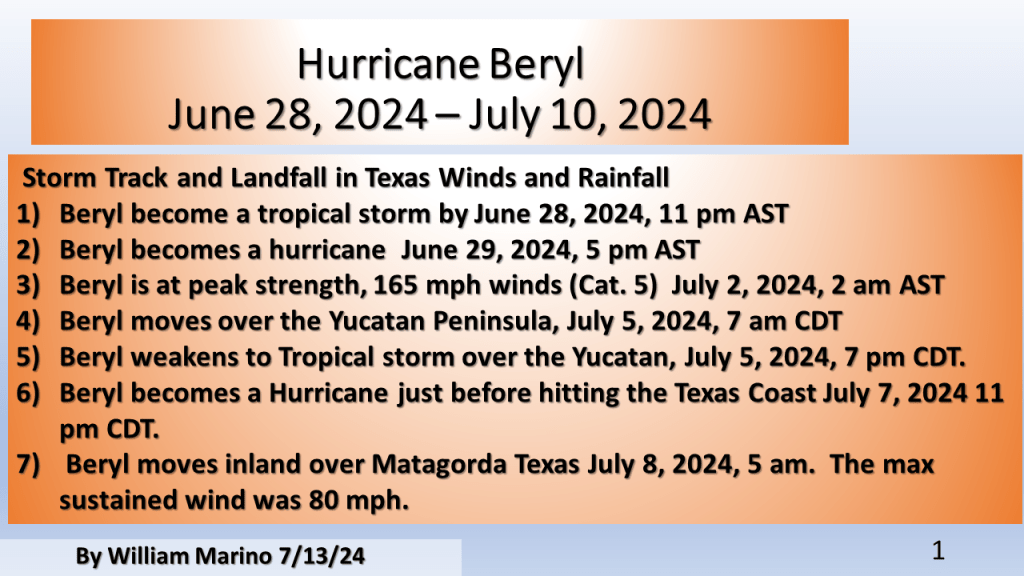
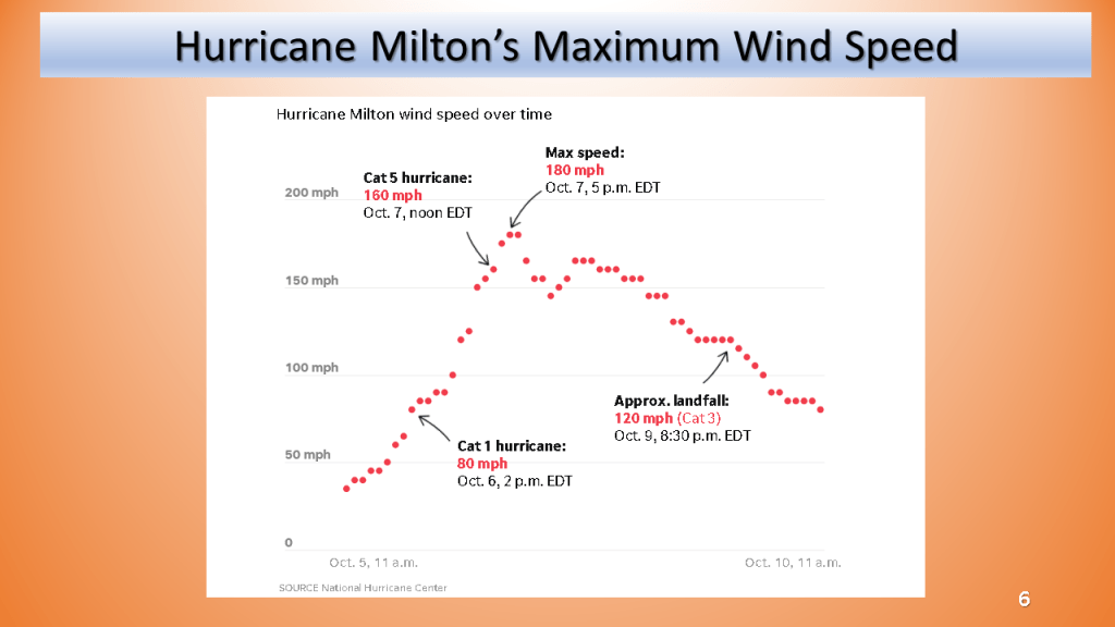
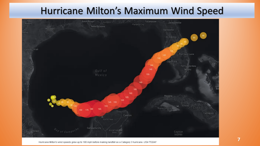
This is by no means a compressive summary, it’s what I could find using NWS data from various sources. I updated the max wind speed and added slides for the track and maximum wind speed with time (from NHC and USAtoday)

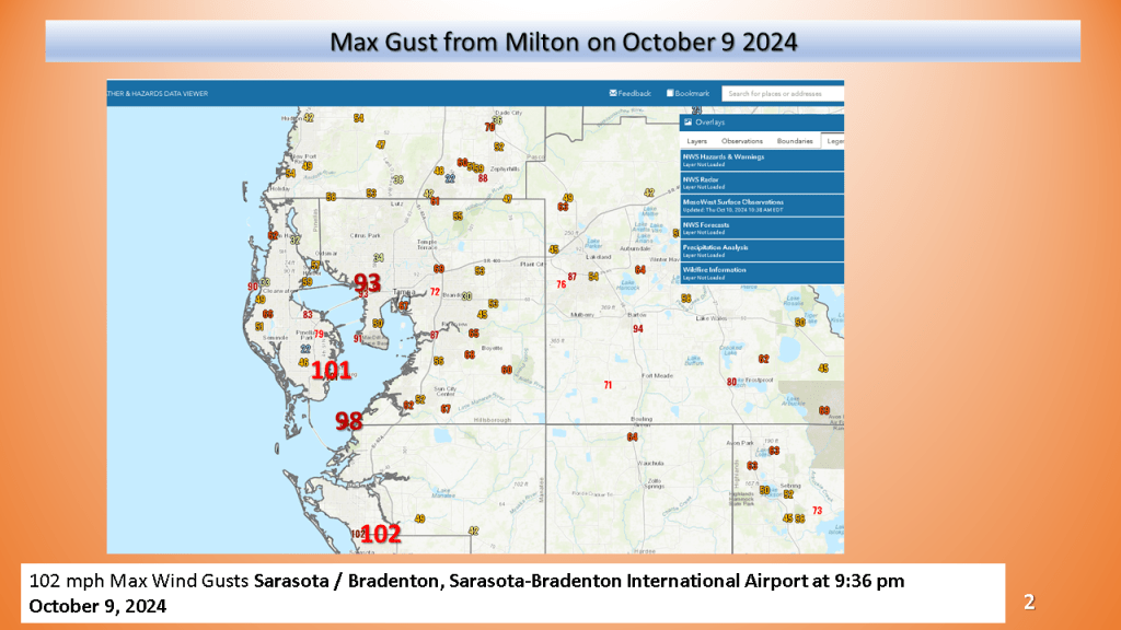
https://www.wfla.com/news/local-news/hurricane-milton-brings-100-mph-wind-gusts-to-tampa-bay/
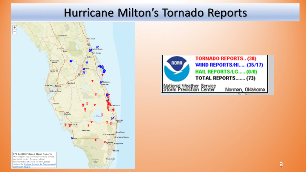
Here are a few links to see details on the tornadoes
Jacksonville
https://www.weather.gov/jax/TropicalEventSummary
Miami
https://www.weather.gov/media/mfl/TropicalEventSummary/PSHMFL_2024AL09_Helene_Summary.pdf
Tampa
Beryl was the first Category 4 hurricane to form in the month of June. The previous record was Dennis when it became a Category 4 hurricane on July 8, 2005.