Storm Summary for the 27th into the 28th of February, 2024

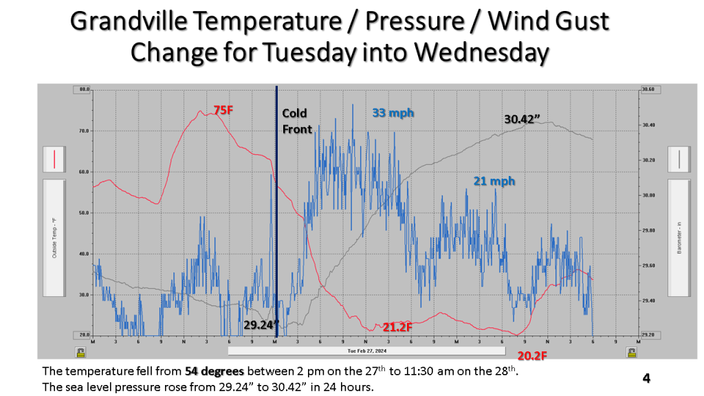
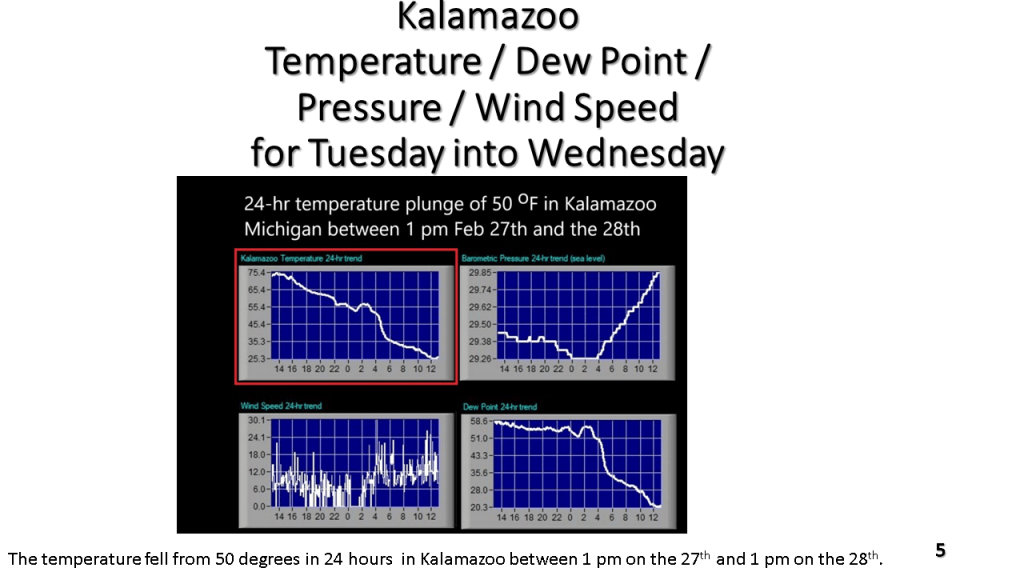
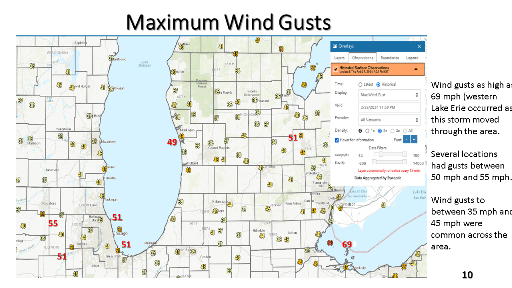
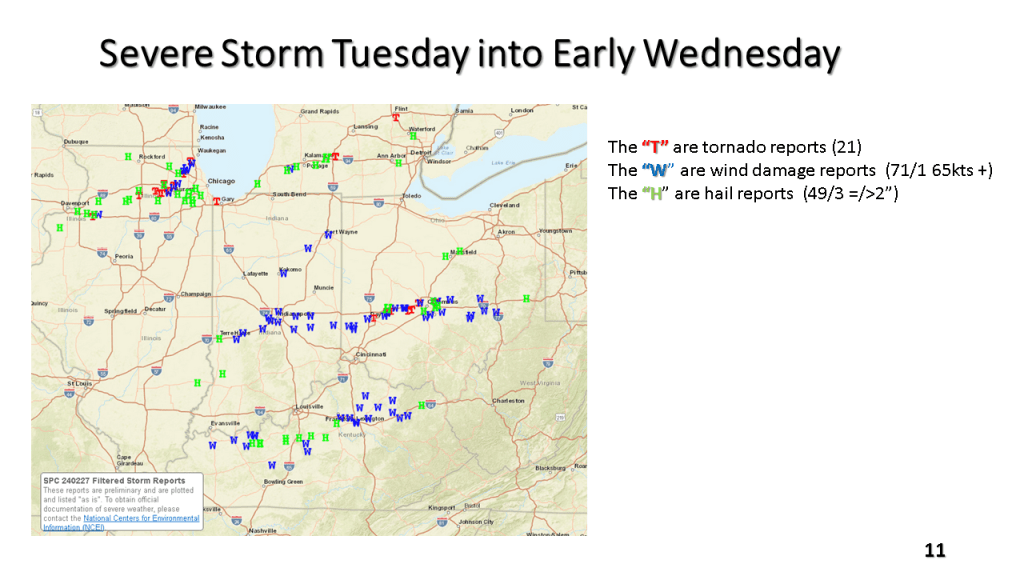
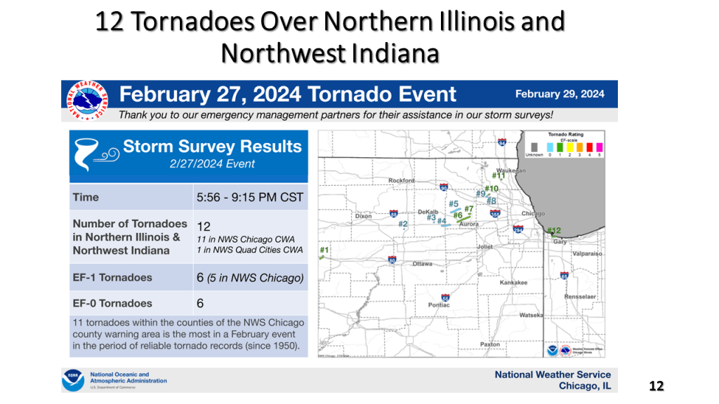
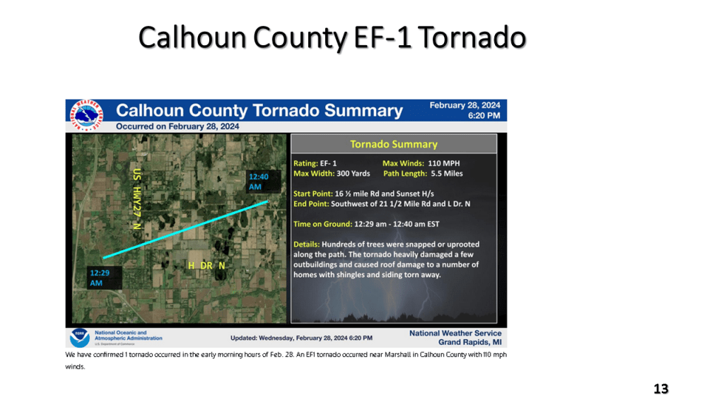
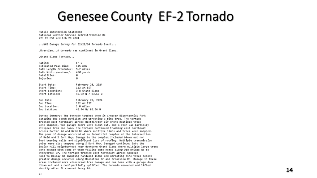
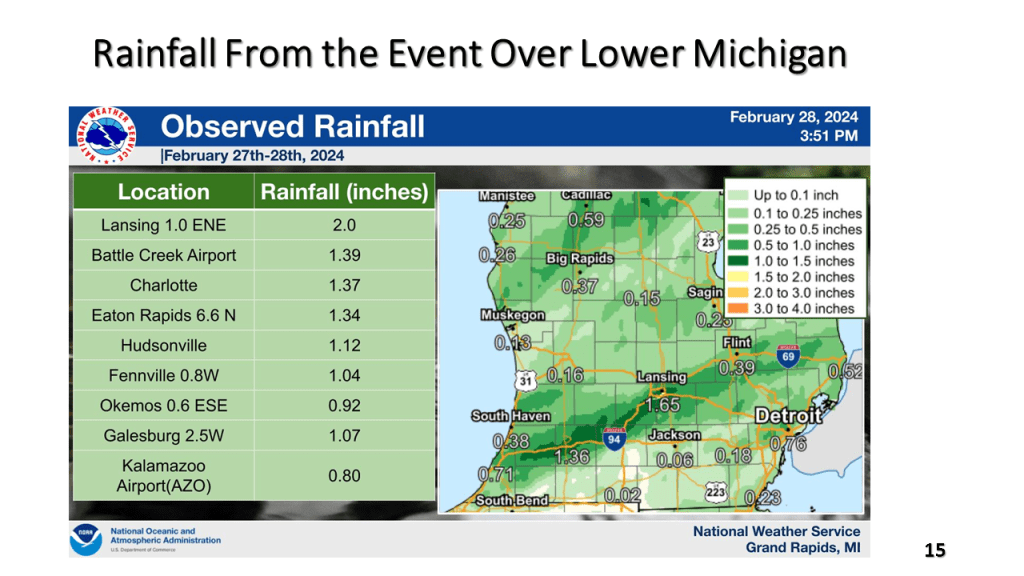
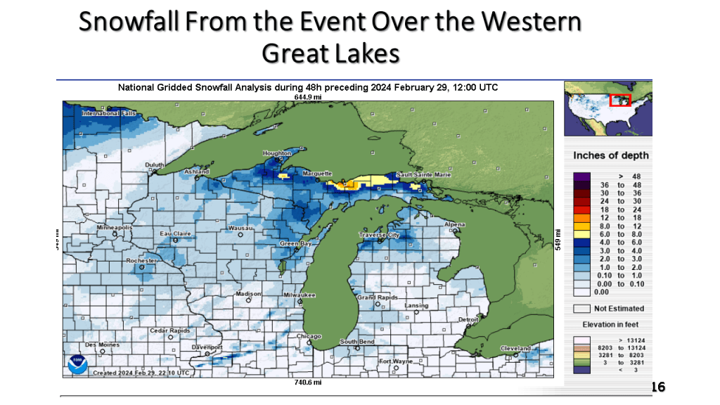
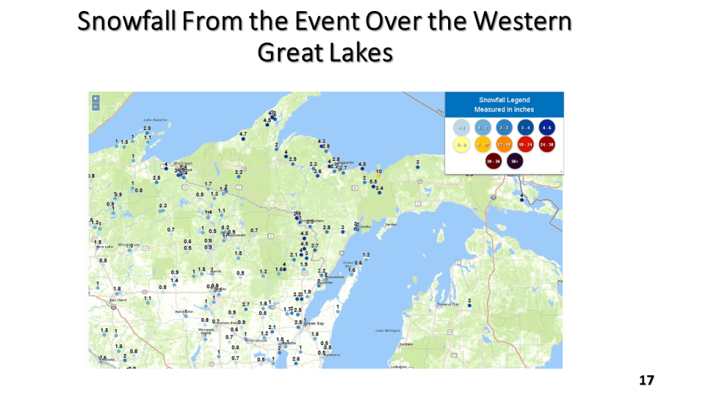
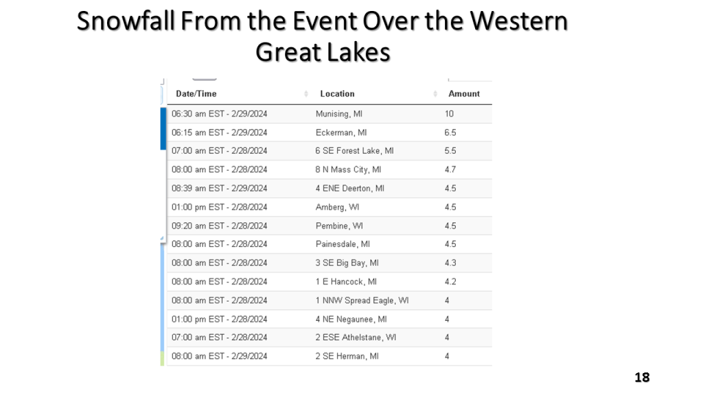
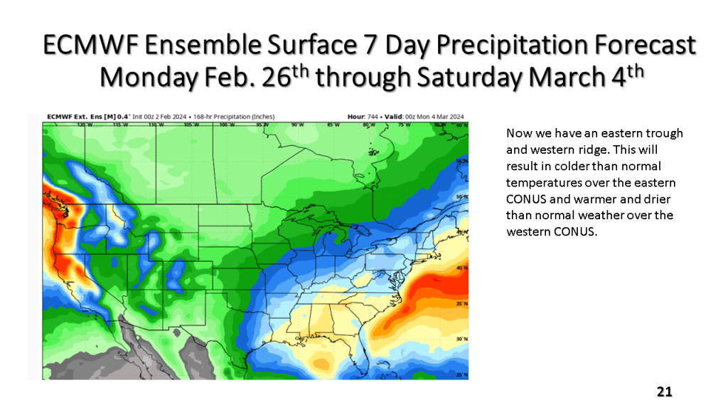
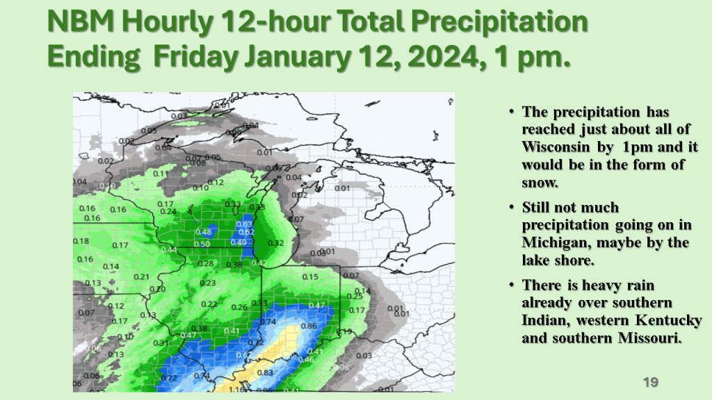
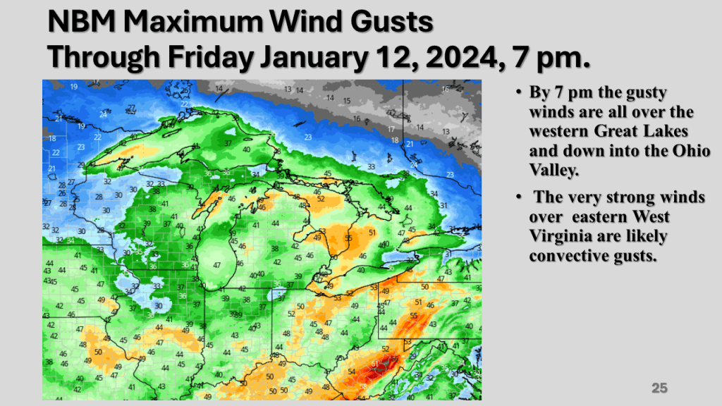
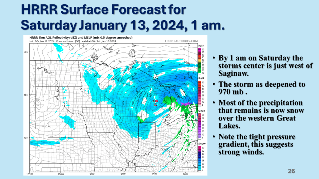
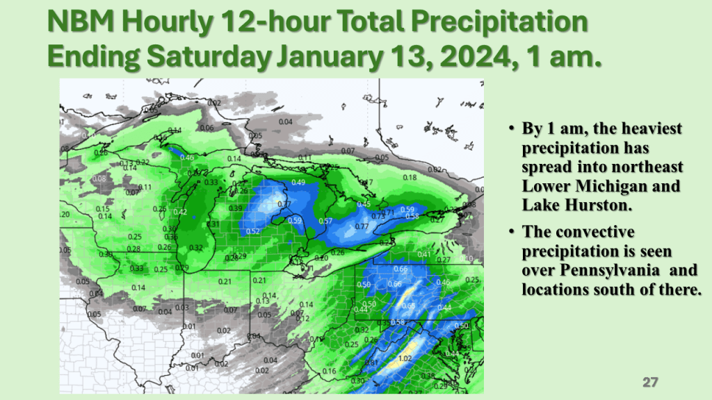
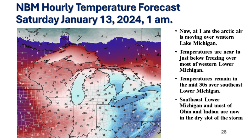
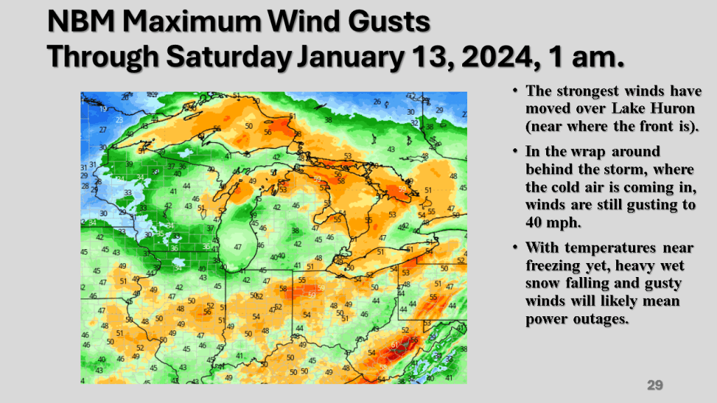
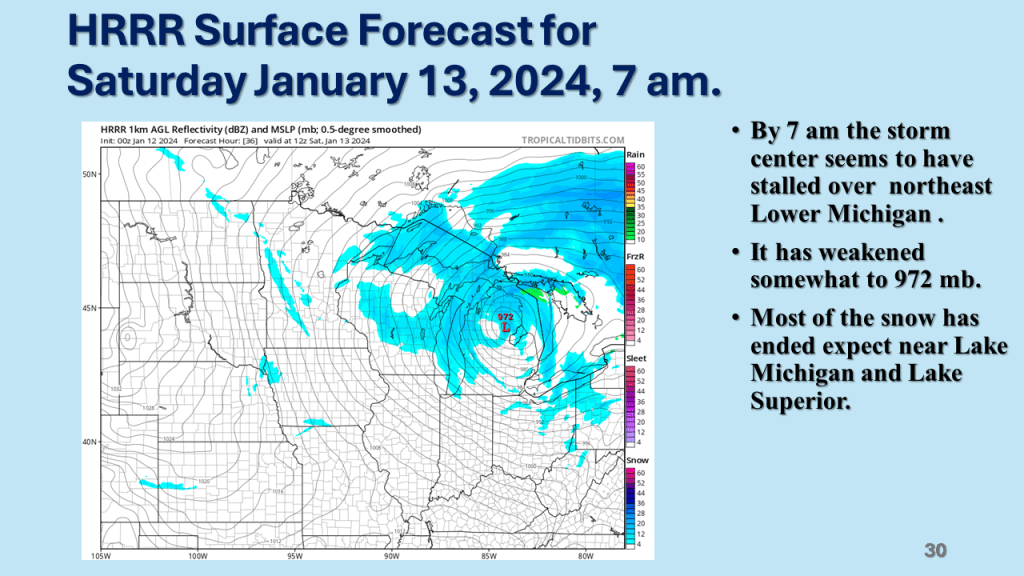
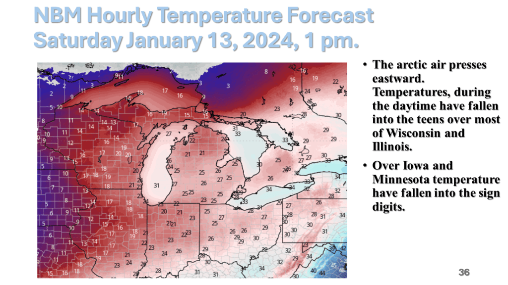
Record high temperatures ( many cases all time record highs for February) were quickly brought to an end by a strong late February cold front. There were 21 reported tornadoes, mostly EF-0 and EF-1 but there was an EF-2 near Grand Blanc in Geneses County just ahead of the cold front. Temperatures fell around 50 degrees between Tuesday afternoon and Wednesday afternoon over Lower Michigan. There was 6 to 10 inches of snow in upper Michigan and locally 1 to 2 inches of rain in parts of southern Lower Michigan. Winds gusted to 69 mph over western Lake Erie.

Unusually Warm into Friday, then over the next week, the colder air returns over most of the CONUS.

This past 15 days ( Jan. 23- Feb. 7) in Grand Rapids, Michigan were the warmest on record (34.8F) that exceeded the 34.7F for the 15 days ending on January 6th 2012.

It will be unusually warm till next weekend. Then the cold and snow return. This time the cold will not move out as quickly as it did in January.

The bottom line is it will be very warm, relative to normal until around Valentine’s Day, the it will get cold across most of the central and eastern CONUS with a significant amount of snow over the Great Lakes and New England.

Revisiting This December being One of the Warmest on Record for Most of the Western Great Lakes and Northern Plains and a Brief Look at the 2nd Least Percent Snow Cover on Record for December over the Continental United States (CONUS)

I have had quiet a few question on if we will have White Christmas this year. This post will try to answer that.

The short story is if you live in the central or eastern CONUS it is very unlikely you’ll have snow on the ground Christmas morning.

I have updated this to show the percent snow cover and ENSO state for each of the 10 years. At the end I have 2 tables that show the years with the ENSO index numbers and the snow cover for that Christmas. The bottom table sorts the percent snow cover from highest to lowest to see if there is a correlation between the ENSO state and the percent snow cover on Christmas day.

Area Covered By Snow:53%
In 2022, ENSO (El Niño Southern Oscillation) was -1.0 while the MEI index was -1.0 making this a moderate La Niña.
Area Covered By Snow:26.6%
2021 was a moderate La Niña, the ONI index was -1.2 while the MEI index was -1.0.
Area Covered By Snow:26.5%
2020 was ENSO neutral with the ONI index at +0.5 while the MEI index was 0.3.
Area Covered By Snow:28.1%

2019 was ENSO neutral with the ONI index at +0.7 while the MEI index was 0.1.
Area Covered By Snow:24.6%
2018 was a weak La Niña, the ONI index was -0.9 while the MEI index was -0.8.
Area Covered By Snow:49.0%
2017 was ENSO neutral with the ONI index at -0.3 while the MEI index was -0.4.
Area Covered By Snow:44.1%
Area Covered By Snow:
24.6%
2016 was a strong El Niño, the ONI index was +2.5 while the MEI index was +1.9. The ONI at 2.5 was an all time record for the ONI index.
Area Covered By Snow:37.2%
2015 was ENSO neutral with the ONI index at 0.5 while the MEI index was 0.2. This was the start of the strong El Niño that lasted from the spring of 2016 into the spring of 2017.
Area Covered By Snow:35.5%
2014 was ENSO neutral with the ONI index at -0.4 while the MEI index was -0.5.
Area Covered By Snow:41.7%
2013 was ENSO neutral with the ONI index at -0.4 while the MEI index was 0.0.

Below is a table showing the percent snow cover on Christmas

Below is a table showing the percent snow cover on Christmas Day in chronological order.

Below is a table showing ENSO numbers and the percent snow cover on Christmas day for that year sorted from the highest percent snow cover to the lowest. There does not seem to be a significant correlation to the ENSO state and the percent snow cover on Christmas Day.

It is looking like December 2023 will end up being in the top 5 warmest Decembers on record across Michigan. This will likely be true not only in Michigan but across most of the northern CONUS.

So far, as of the 16th, December is averaging 6 to 8 degrees above normal across Southern Lower Michigan. Flint is warmest with +7.8, while while Grand Rapids is the least with +5.5. Most other climate sites are between 6 and 7 degrees warmer than normal through the 16th in Michigan. Over northern Michigan Alpena has the least positive departure with +4.1 while Gaylord is +5.9 and Traverse City is +5.1. We are expecting two cold days (Monday and Tuesday) but the rest of December is expected to well above normal. Thus, December 2023 is likely to be in the top 5 warmest on record over most of Lower Michigan.